Drones help farmers gather field data quickly, make better choices, and increase crop yields
-
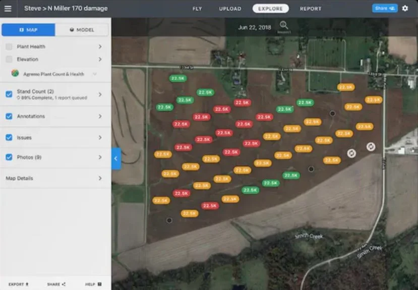
Stand Count Assessments
Quickly survey your field to gather precise data for stand counts and expected crop yields. We tailor the flight plan to fit the crop type, field size, flight route, and row spacing.
-

Crop Health Maps
Utilize Crop Health Maps for variable rate prescriptions and measure pre/post-treatment applications. Enhance insurance claims accuracy by assessing total loss areas post-weather events with aerial maps.
-

Field Edge Insights
Use Live Map software to check your crops easily at the field's edge, even without a cell connection. Quickly spot potential threats to your crops.